Sarajevo and surroundings
Capital hemmed in by four Olympic mountains, where the Ottoman bazaar, the Austro-Hungarian avenue, and the marks of the 1992–1995 siege fit into twelve kilometers of valley.
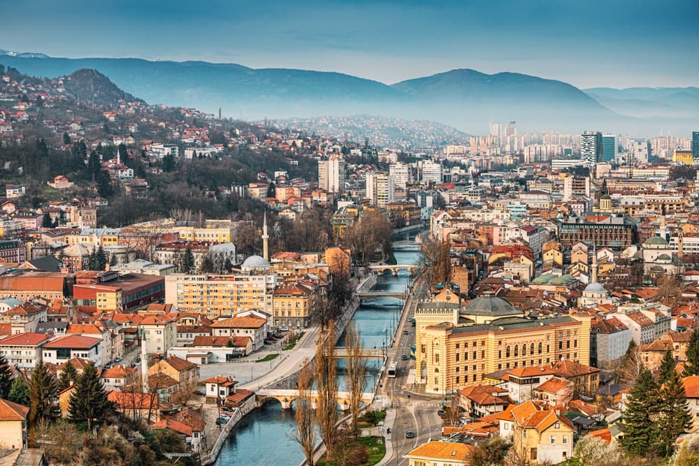
Sarajevo stretches twelve kilometers along the bottom of a deep valley, following the Miljacka river, at 500 meters elevation. The mountains surrounding it (Trebević, Igman, Bjelašnica, Jahorina) hosted the 1984 Winter Olympics and remain the city's lungs today: ski station in winter, hiking and blueberry picking in summer. This basin geography explains everything, from the mediocre air quality in January because of coal stoves to the extreme concentration of urban fabric that makes the city walkable in just a few days on foot.
Our local agency recommends approaching Sarajevo through its chronological layers, visible in the streets. Start at Baščaršija, the 15th-century Ottoman bazaar founded by Isa-Beg Ishaković, with its copper workshops on Kazandžiluk, the Gazi Husrev-beg Mosque, the Morića Han caravanserai, and Sebilj fountain. Three hundred meters further, you step into the Austro-Hungarian city: facades of Ferhadija, the Catholic cathedral, Markale market, then the Vijećnica town hall in pseudo-Moorish style, burned in August 1992 and reopened in 2014. Further west, the towers of Marijin Dvor and Zmaja od Bosne avenue (the former "sniper alley") tell the story of socialist Yugoslavia and the 1992–1995 siege.
Religious coexistence here is physical: along 400 meters of Ferhadija street, you find a mosque, a Sephardic synagogue (the Jewish community arrived from Castile in 1565), an Orthodox church, and a Catholic cathedral. This is why Sarajevo is often called the Jerusalem of Europe. The 1992–1995 war shifted this diversity: the city now counts roughly 80 percent Bosniak Muslims, compared to 50 percent before the conflict. Traces are everywhere, from the "Sarajevo roses" (mortar impacts filled with red resin) to the D-B tunnel beneath the airport runway, 800 meters long, which supplied the besieged city for 1,425 days.
When it comes to food, Sarajevo is eaten with your hands. Ćevapi (grilled minced meat rolls, served by the dozen in somun bread with raw onion and kajmak) is the signature dish: our picks are Petica Ferhatović or Željо, in Bravadžiluk. Burek, a phyllo pastry pie with meat, is had at Sač or Bosna. For sweets, tufahija (baked apple stuffed with walnuts) and hurmašica are enjoyed at ašćinica, traditional canteens serving at the counter. Bosnian coffee, brewed in a džezva and served with rahat lokum, is drunk slowly, never on the go.
Thirty minutes' drive away, the landscape changes character. Mount Trebević, at 1,627 meters, is reached by cable car that reopened in 2018; you can walk along the former Olympic bobsled run, abandoned and covered in graffiti since the 2000s. Ilidža Park, 12 kilometers from the center, shelters the sources of the Bosna river (Vrelo Bosne), accessible on foot or by horse-drawn carriage from the tree-lined avenue planted by Francis Joseph. The villages of Lukomir, at 1,469 meters on the Bjelašnica plateau, and Umoljani, reachable by rough road between June and October, preserve dry-stone architecture and shepherds who still practice transhumance. This is rural Bosnie an hour from the capital.
Allow three full days for the city itself, and a fourth if you want to climb Bjelašnica or walk through Rakitnica canyon. Sarajevo is not a city of isolated monuments to check off, but a fabric to explore neighborhood by neighborhood, sitting down often.
To discover
Baščaršija and the Kazandžiluk copper workshops. The old Ottoman bazaar and its street of coppersmiths, where a dozen workshops still hand-hammer copper to make džezve and trays. Have your first Bosnian coffee at Caffe Divan, in the former Morića Han caravanserai.
Tunnel of Hope and the Sarajevo siege. The D-B tunnel, dug in 1993 beneath the airport runway, can be visited on the Butmir side with 25 meters preserved. The attached museum documents the 1,425 days of siege with maps, videos, and everyday objects.
Trebević cable car and bobsled run. Eight-minute ascent to 1,164 meters, then a one-hour walk along the 1984 Olympic run, abandoned in the forest and entirely covered in graffiti. Sweeping views over the Sarajevo basin.
Bosna springs at Ilidža. At the foot of Mount Igman, the Bosna river emerges in several springs within a park landscaped under Austro-Hungarian rule. Reach it via 3.5 kilometers of plane tree-lined avenue by horse-drawn carriage or on foot from tram line 3's terminus.
Lukomir village on Bjelašnica. At 1,469 meters, Bosnia's highest inhabited village, accessible by rough road May through October. Stone houses with shingled roofs, pramenka sheep herds, and the trailhead to Rakitnica canyon, 800 meters below.
When to visit
Sarajevo is comfortably visited from May to October. May and June offer temperatures of 18 to 24 degrees, lush mountain vegetation, and little rain. July and August reach 28–30 degrees during the day but drop to 16 degrees at night thanks to altitude; this is the best period to combine city and mountain hiking on Bjelašnica or Treskavica. September and October are our preferred months: clear light, forests turning red around Trebević, terraces still open until mid-October.
In winter, December to March, it's cold and snowy: averages from -1 to 4 degrees, frequent snowfall in the city, up to 1.5 meters on Jahorina and Bjelašnica where skiing is in full swing. The basin traps pollution in January–February; the air can be heavy for days on end. November and early March are periods we avoid: gray skies, temperatures around 5 degrees, no skiable snow yet, poor light. Mountain villages like Lukomir remain inaccessible by car from November to April.
Practical advice
Allow three full days for inner Sarajevo: one day for Baščaršija and the Ottoman city, one day for the Austro-Hungarian city and siege sites (tunnel, Vijećnica, cemeteries), one day for Trebević and Ilidža. Add a fourth day if you want to climb Bjelašnica, hike to Lukomir, or descend into Rakitnica canyon. The international airport is 12 kilometers from the center, connected in 20 minutes by taxi. The city is explored on foot and by tram, with distances compressed in the valley.
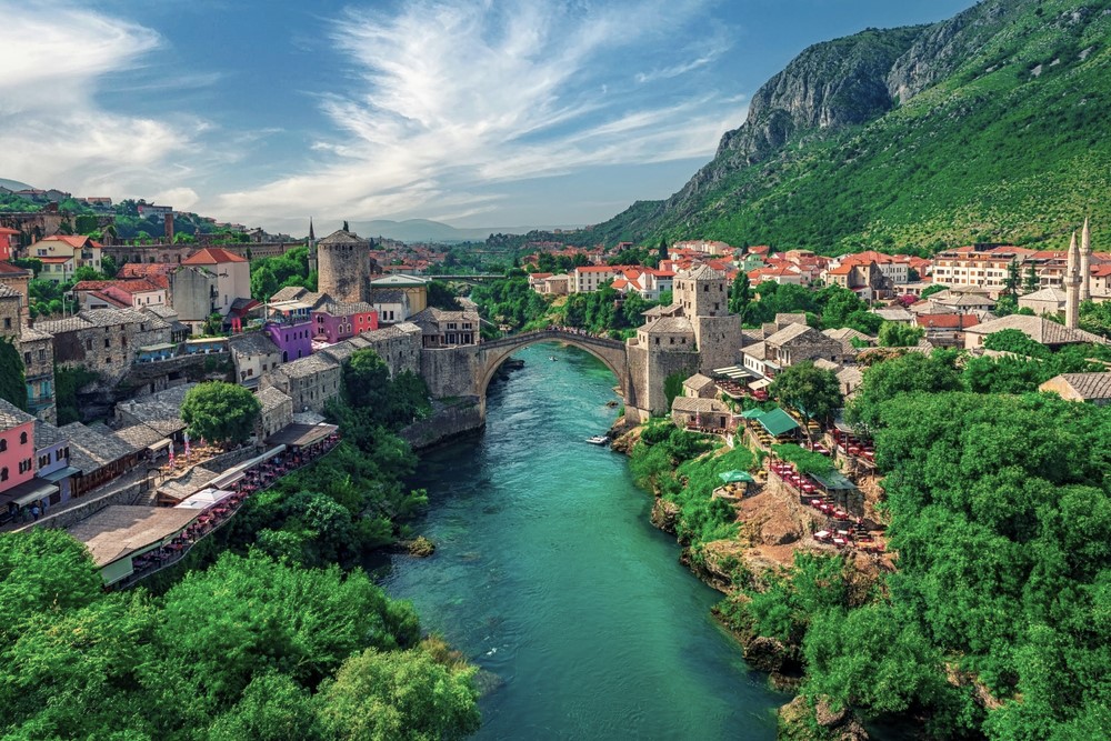
Sarajevo is the logical entry point for a Bosnian circuit. We most often follow it with Herzégovine and Mostar to the south, 2h30 away by the scenic M-17 road that traces the Neretva, or with central Bosnie (Travnik, Jajce) to the west, two hours away. To the east, Sutjeska National Park and the Maglić massif are reached in 3 hours via Foča. Hotel comfort in the city is adequate, from Ottoman boutique hotels in Baščaršija to contemporary four-star properties at Marijin Dvor. The destination suits urban travelers and historians, food lovers, and hikers if you combine it with a night in the mountains. Families with children: plan the Trebević cable car and Ilidža springs, always crowd-pleasers.