Eastern Bosnia and Sutjeska
Bosnia's least-traveled region: Perućica primeval forest, the Maglić summit, the Tara canyon and Višegrad's Ottoman bridge over the Drina.
Eastern Bosnia occupies the country's southeastern quarter, wedged between the Drina marking the Serbian border and the mountain ranges that slope toward Montenegro. It's the least populated region of Bosnia and Herzegovina, and the one we take travelers to when they want to understand what truly lies behind the expression "wild Balkans." Roads wind between reliefs ranging from 1,800 to 2,400 meters, villages often have fewer than 200 inhabitants, and it's not uncommon to spot more horses grazing than cars on certain stretches between Tjentište and Sutjeska.
Sutjeska National Park, established in 1962, forms the heart of the region. It protects Perućica, one of Europe's last primeval forests: 50-meter beeches and firs, fallen trees left on the ground for decades, access strictly monitored by a forest ranger. The Maglić rises to 2,386 meters and marks the country's highest point. The ascent takes two days with an overnight at Prijevor refuge, rather than a quick up-and-back from the valley. On the wildlife side, brown bears, wolves and chamois are present in significant densities, and park biologists have been conducting GPS tracking for twenty years—work that also helps orient our off-season hikes.
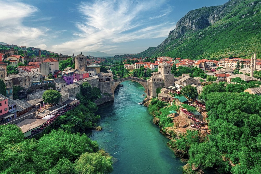
Further north, Višegrad owes its renown to the bridge over the Drina built in 1577 by Ottoman architect Mimar Sinan for Grand Vizier Mehmed Paša Sokolović, himself taken as a child from a nearby village. Ivo Andrić drew from it the novel that won him the Nobel Prize in 1961. The UNESCO-listed bridge takes five minutes to cross on foot, but we take time to pause at the kapija, the central terrace where residents still gather in the evenings. Nearby, the Andrićgrad complex, built between 2011 and 2014 by filmmaker Emir Kusturica, divides opinion: pastiche architecture to some, local economic revival to others.
Foča, 70 kilometers south of Sarajevo, serves as the logistics base for the Tara. This 1,300-meter-deep canyon, the world's second-deepest after the Colorado, is navigated by rafting from April to October. Classic sections run 10 to 25 kilometers, grades III to IV depending on water flow, with overnight stays at wooden camps beside the water. The river remains one of Europe's cleanest; you can drink from it directly. The local operators we work with are based at Brodarevo or Bastasi and have guided groups for three generations.
The region also carries heavy memory. Foča and the Drina valley were major theaters of the 1992-1995 war, and several Muslim villages were never repopulated. We address this chapter when travelers wish, with guides who lived through the period. The cuisine remains that of a livestock region: lamb cooked under the sač (cast-iron dome covered with embers), creamy kajmak from high pastures, grilled Drina trout, and cheese-filled pita in the konobas of Tjentište or Šćepan Polje.
To discover
Maglić ascent over two days. Climb from Prijevor via the glacial lakes of Trnovačko, night at a spartan refuge, sunrise at the summit at 2,386 meters with views over Montenegro's Durmitor.
Perućica primeval forest. Mandatory guided walk of 4 hours from Tjentište through 300-year-old beeches, to a viewpoint over Skakavac waterfall, a 75-meter drop.
Rafting on the Tara. 25-kilometer descent over two days from Brstanovica, turquoise waters graded III-IV, bivouac at the Drina-Tara camp in the gorges.
Mehmed Paša Sokolović Bridge at Višegrad. Eleven Ottoman arches spanning the Drina since 1577, crossed on foot at dusk when Višegrad's residents come to sit on the central kapija.
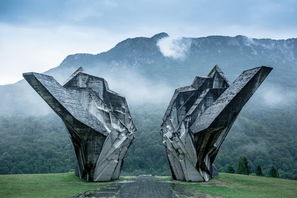
Forgotten Sutjeska Valley. Road from Tjentište to Šćepan Polje with stop at the brutalist monument to the 1943 battle, livestock hamlets and family inns serving lamb cooked under sač.
When to visit
Hiking season runs from mid-June to mid-September. Before then, snow still blocks the heights of Maglić and Zelengora, sometimes until early July on north-facing slopes. July and August offer the most stable conditions: 22 to 28°C in the valleys, 12 to 18°C above 1,800 meters, frequent but brief afternoon storms. September remains our favorite month, still mild temperatures, forests turning ochre, and less crowded refuges. Rafting on the Tara operates April to October, with strong flows in May (snowmelt, sustained grade IV) and calmer waters in August-September, better suited to families.
From October to May, the region empties. Passes exceeding 1,500 meters close intermittently from November onward, park refuges are shuttered, and temperatures drop to -10°C in January in the high valleys. Višegrad and Foča remain accessible year-round via main roads, but accommodation dwindles sharply outside season.
Practical advice
We recommend a minimum of 4 days in the region to combine Sutjeska (2 days of hiking), the Tara (1 day of rafting) and Višegrad (1 day with the narrow-gauge Šargan Osam train on the Serbian side as an option). Allow 6 to 7 days if you want to climb Maglić and explore Zelengora. Access is from Sarajevo, 2.5 hours' drive from Foča and 3.5 hours from Tjentište via the M20. No regional airport; transfers are in a private vehicle with our driver.
The most coherent combination is with Sarajevo and surroundings either before or after, since the capital serves as the logistics gateway. Travelers with 12 days or more often continue into Herzegovina and Mostar via the scenic road through Gacko, or extend to Durmitor in Montenegro from Šćepan Polje, 15 minutes from the border crossing. Comfort remains rustic in the park: family guesthouses of 3 or 4 rooms, refuges without hot water, meals served at set times. The region suits hikers, river enthusiasts, and contemplative travelers ready to accept days without cell reception. Less suitable for families with young children, except when limiting yourselves to Višegrad and the easy sections of the Tara.